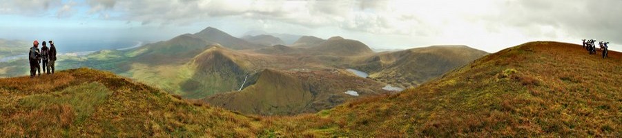
It will give a grid reference for your exact location for you to pass to emergency services. You don't need a phone signal, so very useful in the depths of devon.
Glad you're generally impressed with the app. I'm one of those sad gits who quite likes doing the trails on his own, so I agree it could be a life-saver (although obviously I hope not!!).
I'm also a North Devon area volunteer for the Air Ambulance, so gonna fly the flag by reminding everyone that the service depends entirely on donations! So if you see one of our collection boxes when you're out and about feel free to bung in your loose change - every penny counts.
Thats pretty good. What happens when you press dial? does it send the coordinates in any form, or do you then just connect to the emergency services in the normal way?.
Thats pretty good. What happens when you press dial? does it send the coordinates in any form, or do you then just connect to the emergency services in the normal way?.
Thats pretty good. What happens when you press dial? does it send the coordinates in any form, or do you then just connect to the emergency services in the normal way?.
I think it will connect in the usual way, but you can tell them immediately where you are by supplying the map reference shown - better than saying that you're wedged in a 5 foot deep tree-covered gulley somewhere near Molland...
I don't think it's sophisticated enough to actually beam out a signal (hence the SOS torch to shine skywards), but don't quote me on that!!
Their monthly magazine has interviews with people who've been airlifted - I could tell them all about the TRF and the joys of riding ancient highways!!
Great piece of advice and have download both Devon AA and St Johns however as I'm currently in Milan they might not pop out if needed, but I'll be back on the lanes this weekend
I have just installed this app, works brilliantly. As I don't know where I am most of the time I would have no idea how to give directions to an ambulance. This makes it really easy.
Be warned (not knocking the app BTW) that though the Air Ambulance may 'accept' a grid ref many normal emergency service controllers won't and will only work to a post code.
An issue we have at work due to the remote locations we operate in often far from the nearest road - I may be proved wrong and things have changed over the past year or so but a google search finds many posts on Rambler/Walking sites stating the same issue.
Railway needs to play catch-up! It's not difficult to translate a grid ref to the post code it resides in, especially in an app (or create a bespoke one to do it for you). Alternatively, NR should supply the emergency services with a list of their remote locations should they need to be accessed in an emergency - there are forums (not internet ones like this, but actual groups that meet) where this stuff is dealt with and I'd be surprised if your H&S people aren't involved.
Incidentally, how does this Air ambulance app work? Top post says it works without a phone signal which makes sense (assisted GPS and all that), but without a signal how can you make the call?
We do have an App the gives post codes (and railway mileages) - You missed my point, I was saying that's how I knew GF's were an issue.
So do we supply the emergency services a list of all the lanes we ride, the ramblers a list of all the paths they walk, the railway a list of - well the whole railway etc etc - or could the emergency services 'play catch up' and gain the ability to understand what a grid ref is?
So do we supply the emergency services a list of all the lanes we ride, the ramblers a list of all the paths they walk,
Nope, because it's not work. In my past experience I've not had an emergency service operator decline grid references although, as you say, they do prefer a proper postal address.
The DAAT APP has been dropped due to costs + frequent updates needed
So the DAAT team are now using the 'Three word app' for the same purpose.
Plus you might notice the below text as saying they do take a grid reference, so keep them GPS's handy on the trails + stay safe
How is Devon Air Ambulance using the What3Words app?
Our HEMs dispatchers use the 3 words given to them when receiving a call and translate these into the coordinates they need to direct the emergency aircraft to the precise location where our critical care team is needed. For those who are calling for help from remote locations and might not have the grid references to hand, this application can be very useful.